


monfiot 10 9 2020

Valmeinier
User
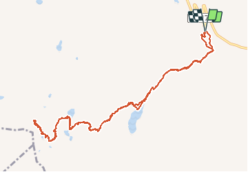

Length
13.5 km

Max alt
2674 m

Uphill gradient
857 m
Km-Effort
25 km

Min alt
1845 m

Downhill gradient
853 m
Boucle
Yes
Creation date :
2020-09-10 06:26:02.431
Updated on :
2020-09-10 12:51:30.592
6h23
Difficulty : Very easy

FREE GPS app for hiking
 SityTrail
IGN / Geographical institutes
SityTrail Plus
The world is yours!
About
Trail Walking of 13.5 km to be discovered at Auvergne-Rhône-Alpes, Savoy, Les Belleville. This trail is proposed by Valmeinier.
Positioning
Country:
France
Region :
Auvergne-Rhône-Alpes
Department/Province :
Savoy
Municipality :
Les Belleville
Location:
Saint-Martin-de-Belleville
Start:(Dec)
Start:(UTM)
307673 ; 5019871 (32T) N.
Comments